
Phone : 0466 833 407
|
Phone : 0466 833 407 |
| Asset Inspections | Photography / Filming | Mapping / Searches |
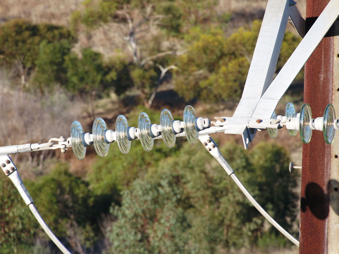
Asset InspectionsSouthern Drones offers a low cost way to inspect assets such as towers, aerials, antennaes and roofs. Our UAVs are also a very efficient way to record footage for insurance purposes, etc. For inspection work we have a DJI Matrice 210RTK with Z30 camera (30x zoom lens). This allows us to maintain a safe distance away from powerlines, antennaes, turbine blades, radio transmitters while still obtaining accurate and clear photos and video footage where required. We can create 3d models of the asset. We always have a backup drone on site. Infra-red inspection capability coming soon and available for large projects.
|
Aerial Photography and FilmingSouthern Drones operates DJI Inspire 2 and Phantom 4 Pro RPAs. For the large majority of aerial photography and filming, these provide very high quality photos (at resolutions of up to 5472 x 3648 pixels and 4k hd footage (@60fps), while minimising impact on local inhabitants.
|
Airborne SearchesSouthern Drones is run by a professional helicopter pilot with many hours of experience of conducting searches. We understand the correct methods of searching an area and ensuring that it is adequately viewed and marked as completed.
|
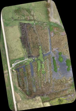
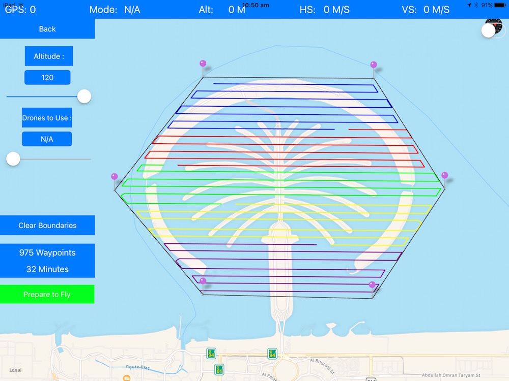
MappingSouthern Drones can offer mapping and survey data aquisition services operating DJI Matrice 210 RTK RPAs with X4S camera (mechanical shutter) and Phantom 4 Pro. Give us a call any time to discuss your needs. We are professional and affordable. Providing 2d and 3d orthomosaic maps through third party software.
|
| CONTACT US FOR A FREE QUOTE |
|
Equipment Links . Manufacturer Links . Events . Software Links . OZ VTOL |